 Contact
 Donate
 Languages
 Events
 Visit Greenways
 Get Involved
 How We Work
About
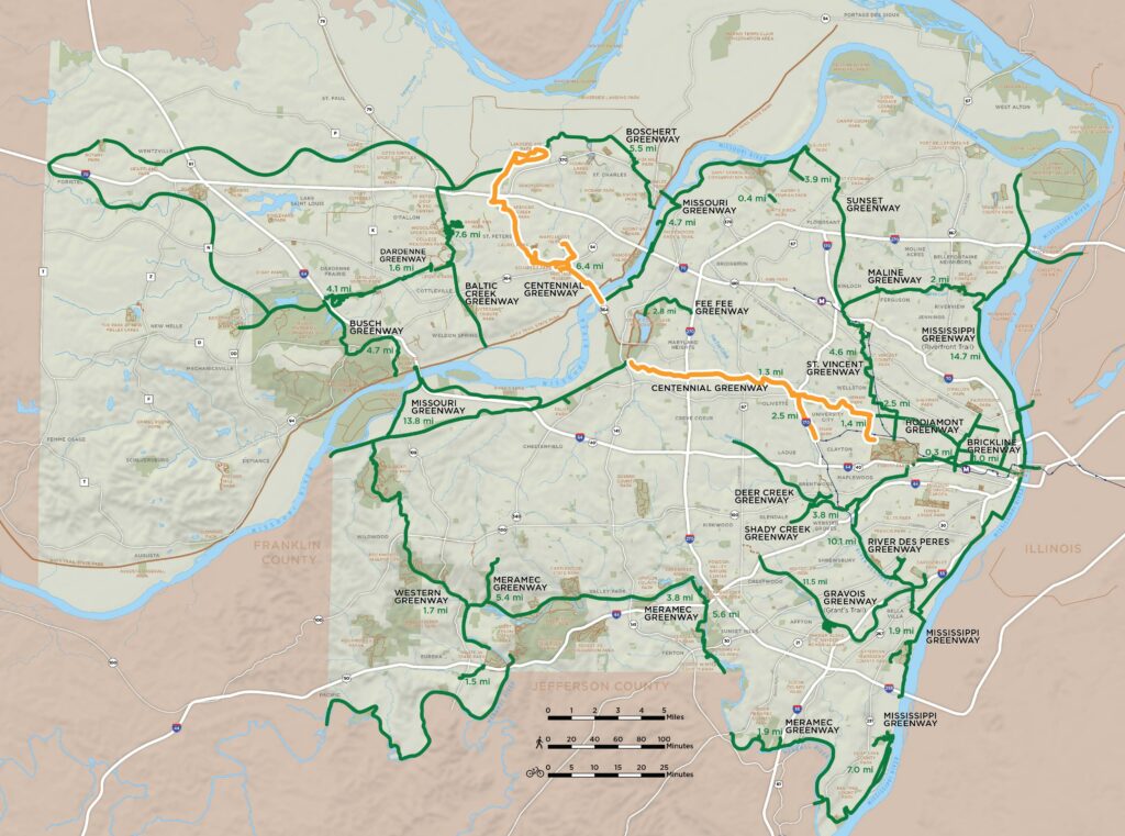
The plan for the Centennial Greenway calls for a 17-mile corridor that stretches between Forest Park in the City of St. Louis and St. Charles County. The greenway will connect St. Louis, University City, Olivette, Ladue, Clayton, Creve Coeur, Maryland Heights and St. Peters in St. Charles County. In addition to connecting communities, it will also connect some of the St. Louis region’s most treasured parks and green spaces including Forest Park, Shaw Park, Indian Meadows and Warson Park, and the Katy Trail.
Where did the name Centennial come from? The St. Louis World’s Fair, also known as “The Louisiana Purchase Exposition of 1904” celebrated the centennial of President Thomas Jefferson’s real estate deal with Napoleon Bonaparte of France: $15 million for 600 million acres of the Louisiana Territories. Because a portion of this greenway follows the same route of the 1904 Olympic marathon held in St. Louis as part of the World’s Fair, it was given the name Centennial!
Please note, if you saw dashed lines representing “Future Greenways” on the interactive map but don’t see those segments listed here, those projects are part of the overall plan but haven’t yet been studied individually. As soon as there is information to share and an opportunity for community engagement, those projects will have their own pages linked here!
Greenways to Visit
- Centennial Greenway: Forest Park to Washington University to Vernon
- Centennial Greenway: Katy Trail to Schaefer Park to Spencer Creek Trail
- Centennial Greenway: Shaw Park to Olive
- Centennial Greenway: Warson Park to Dielman Rd
Greenways in Progress
- Centennial Greenway: Dielman Road to Olive Blvd
- Centennial Greenway: Schuetz Road between US 67 and Gandy Drive
- Centennial Greenway: Spencer Creek Trail Improvements
- Centennial Greenway and 39 North Greenway
- Centennial Greenway: Vernon Avenue between Heman Park and Ackert Walkway
- Centennial Greenway: Heman Park to I-170
- Centennial Greenway: Creve Coeur Park to I-270