Skip to content
Great Rivers Greenway
Menu
Live Life Outside
  • Greenways
  • Plans & Projects
  • Events
    • Life Outside Challenge
    • Mary Meachum Celebration
    • Eagle Days
    • Post an Event
    • Your Event on a Greenway
  • Jobs/Bids
  • About
    • Mission & Vision
    • What is a greenway?
    • Board & Staff
    • Diversity, Equity and Inclusion
    • Regional Partnerships
    • Resources & Documents
    • GRG Foundation
    • News
    • Contact Us
  • Conservation
    • Planning and Building for Conservation
    • Restoring and Creating Healthy Habitats Along the Greenways
    • Engage and Give Back
  • Donate
  • Volunteer
  • Languages
    • English
    • Español
    • Bosanski
    • 中文
    • Tiếng Việt
    • हिंदी

3 Ways to Find Greenways

Search Map List

All search criteria and categories are optional, pick and choose what matters to you to discover a new place to explore!

Which part of the region would you like to explore?

OR
Loading...

Error.

What's important to you?

Parking
Restrooms
Playground
Benches
Tables
Shelters
Drinking Water
Trash
Bike Racks

What do you want to do?

Explore History
Fish
Dine
Swim
See Wildlife
Boat
Grill
Camp
Play

What is your favorite type of trail?

Paved
Unpaved
Less Than 4 Miles
4 Miles or More
Hilly
Flat

What is your ideal greenway experience?

Sunny
Shady
Urban
Rural
Popular
Hidden Gem
Waterways

How do you get around?

Bike
Bus
Metro
Car

Boschert Greenway

New Town to Historic St. Charles to Katy Trail

The Boschert Greenway is in St. Charles County and links the Missouri River and  Katy Trail, goes through Historic Downtown St. Charles, through Fox Hill Park and up to New Town, a planned community within the city of St. Charles. You can also connect to St. Louis County and the Missouri Greenway: Earth City Levee via a new protected walking and biking path on the 370 Discovery Bridge.

Click here to download a printable Greenway Adventure Guide for the Boschert Greenway: New Town to Historic St. Charles to Katy Trail.

Total trail length: 5.45 Miles

Brickline Greenway

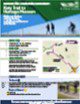
Boyle Avenue to Sarah Avenue

Overview of this project: GreatRiversGreenway.org/brickline/

This page is dedicated to the first segment of the Brickline Greenway (formerly known as the Chouteau Greenway), which will connect Forest Park to the Gateway Arch and provide connections to Fairgrounds Park and Tower Grove Park, runs between Boyle Avenue and Sarah Avenue within the City of St. Louis. This short segment parallels the MetroLink light rail line, and provides a connection to the Cortex Innovation Community.

Total trail length: 0.27 Miles

Busch Greenway

Katy Trail to Missouri Research Park to August A. Busch Conservation Area

This greenway combines beautiful settings like hardwood forests and a creek with a bustling research park full of businesses and natural conservation areas. It connects the Missouri State Parks’ Katy Trail to the University of Missouri’s Research Park to the Weldon Spring and Busch Conservation areas, going by Francis Howell High School and Highway 94 in the process. Walkers, runners and bikers alike enjoy getting some fresh air on this scenic, sunny route!

Click here to download a printable Greenway Adventure Guide for the Busch Greenway: Katy Trail to Missouri Research Park to August A. Busch Conservation Area.

Total trail length: 4.73 Miles

Centennial Greenway

Forest Park to Washington University to Vernon

This portion of the Centennial Greenway stretches from Skinker Boulevard and Forsyth Boulevard at Forest Park. It meanders through the Washington University Campus, along Kingsbury Avenue to Delmar Boulevard (at Melville Avenue) in the Loop Business District and north to Vernon Avenue.
Click here to download a printable Greenway Adventure Guide for the Centennial Greenway: Forest Park to Washington University to Vernon.

Total trail length: 1.36 Miles

Centennial Greenway

Katy Trail to Heritage Museum

This segment of the Centennial Greenway stretches from the Katy Trail near the Page Avenue extension to the Heritage Museum in St. Charles County. There is also a .7 mile extension over Highways 364 and 94 so people can safely walk or ride a bike across these busy highways; connecting schools, neighborhoods, parks, and businesses to each other as well as other area attractions. They also connect the existing trail system to Wapelhorst Park in the City of St. Charles and Laurel Park in St. Peters.
This greenway offers a direct connection to the paved Creve Coeur Connector trail that takes you across the Missouri River and links up with the paved trails and other attractions in Creve Coeur County Park. You can use the Katy Trail to travel to Historic Downtown St. Charles and Frontier Park. You can also exit the KATY Trail at Olive Street and ride on the street to connect to the Boschert Greenway!

Click here to download a printable Greenway Adventure Guide for the Centennial Greenway: Katy Trail to Heritage Museum.

Total trail length: 2.7 Miles

Centennial Greenway

Shaw Park to Olive

This section of the Centennial Greenway is urban; linking together the communities of Clayton, University City, Ladue and Olivette. It stretches 2 miles along I-170  from the south side of Shaw Park all the way to and along Olive Boulevard. It also connects you to the paved trails within Shaw Park and a wide sidewalk along the north and south sides of Olive between McKnight and Price Rd.
Click here to download a printable Greenway Adventure Guide for the Centennial Greenway: Shaw Park to Olive.

Total trail length: 3.28 Miles

Dardenne Greenway

Barathaven

This section of the Dardenne Greenway parallels Dardenne Creek in St. Charles County, north of Highway 64.

Click here to download a printable Greenway Adventure Guide for the Dardenne Greenway: Barathaven.


Total trail length: 4.12 Miles

Dardenne Greenway

Legacy Park to Dardenne Park

The Dardenne Greenway winds along Dardenne Creek in St. Charles County, and links together hundreds of acres of parks as well as neighborhoods, communities, businesses and schools. There is a paved trail in the greenway that makes it easy for you to to leave your car behind and walk or ride to athletic fields, a dog park, St. Charles Community College or to just get outside and enjoy some fresh air!

Click here to download a printable Greenway Adventure Guide for the Dardenne Greenway: Legacy Park to Dardenne Park.

Total trail length: 6.94 Miles

Deer Creek Greenway

Deer Creek Park to Lorraine Davis Park

This greenway is nestled between the cities of Maplewood, Brentwood and Webster Groves. It parallels Deer Creek and links together parks, businesses, neighborhoods and green space in the area surrounding the confluence of Deer and Shady Creeks.
Click here to download a printable Greenway Adventure Guide for the Deer Creek Greenway: Deer Creek Park to Lorraine Davis Park.

Total trail length: 2.16 Miles

Fee Fee Greenway

Aquaport to Creve Coeur Park

The Fee Fee Greenway parallels Fee Fee Creek, within the Missouri River watershed. It is a suburban greenway that extends from the Maryland Heights Recreation Complex at Aquaport to Creve Coeur Park.

Click here to download a printable Greenway Adventure Guide for the Fee Fee Greenway: Aquaport to Creve Coeur Park.

Total trail length: 2.73 Miles

Gravois Greenway: Grant's Trail

Gravois Greenway (Grant's Trail): River des Peres Greenway to Holmes & Leffingwell

The Gravois Greenway (Grant’s Trail) meanders through seven municipalities and connects several parks, schools, neighborhoods, libraries, historic sites and athletic facilities. It currently extends from a trailhead at Holmes and Leffingwell avenues in Kirkwood to the River des Peres Greenway (just east of Interstate Highway 55 at River City Blvd.) in the city of St. Louis. Runners, walkers and cyclists of all ages can be found year-round enjoying this ribbon of green space linking south St. Louis County and the City of St. Louis.

Keep in mind that this greenway welcomes a lot of people –especially on a warm and sunny day. Be sure to think of other visitors when running, riding a bike or walking your dog. Keep to the right and announce your presence when passing others. Slow down, be courteous and share the greenway so everyone can enjoy the fresh air!

This greenway has a long history and many champions – check out more information on Trailnet’s website.

Click here to download a printable Greenway Adventure Guide for the Gravois Greenway (Grant’s Trail): River des Peres Greenway to Holmes & Leffingwell.

Total trail length: 12.14 Miles

Maline Greenway

Bella Fontaine County Park

This stretch of the Maline Greenway lies primarily within Bella Fontaine County Park. It is the first segment of a planned seven mile, east-west link that will connect the Mississippi and St. Vincent Greenways.  This greenway links both sides of Bella Fontaine County Park via an underpass beneath Highway 367/Lewis & Clark Boulevard. You can walk, ride, push a stroller or use a wheelchair along Maline Creek and spend a few minutes relaxing on one of the benches along the way. There’s also a storybook walk with different books featured each season. The book is displayed page-by-page on progressive boards along the greenway.
Click here to download a printable Greenway Adventure Guide for the Maline Greenway: Bella Fontaine County Park.

Total trail length: 1.6 Miles

Meramec Greenway

George Winter Park to Unger Park

This section of the Meramec Greenway stretches between Unger Park where the river makes a sharp turn south all the way to George Winter Park. There are scenic river views and plenty of recreational green spaces to explore and enjoy along the way. It connects neighborhoods, a light industrial park, parks, a golf course and historic Old Towne Fenton as it meanders through southwest St. Louis County.
Click here to download a printable Greenway Adventure Guide for the Meramec Greenway: George Winter Park to Unger Park.

Total trail length: 5.54 Miles

Meramec Greenway

Glencoe to Sherman Beach Park

This section of the Meramec Greenway has some of the more beautiful views in the River Ring. From the soaring limestone bluffs, the wildflowers in the springtime, and the ever-changing views of the Meramec River, it has something for everyone. It stretches from Sherman Beach in southwest St. Louis County along the river to Glencoe, with a spur north called Rock Hollow, which includes a major hill at the end.

Click here to download a printable Greenway Adventure Guide for the Meramec Greenway: Glencoe to Sherman Beach Park.

Total trail length: 3 Miles

Meramec Greenway

Greentree Park to Arnold's Grove Park

The lush canopy of trees makes it hard to believe this greenway is so close to Highways 44 and 141. You can walk or ride to three parks, go fishing or connect to existing trails. You can also play a round of golf or hit a few golf balls at the Family Golf and Learning Center on Marshall Road. In the summer and fall, you can catch a baseball or softball game at the Kirkwood Athletic Association across from Greentree Park.

Click here to download a printable Greenway Adventure Guide for the Meramec Greenway: Greentree Park to Arnold’s Grove Park.

Total trail length: 3.64 Miles

Meramec Greenway

Lions Park to Route 66 State Park

This section of the Meramec Greenway parallels Highway 44 near the city of Eureka and includes several Eureka City Parks as well as Route 66 State Park that celebrates, “The Mother Road.”
Click here to download a printable Greenway Adventure Guide for the Meramec Greenway: Lions Park to Route 66 State Park.

Total trail length: 1.5 Miles

Meramec Greenway

Lower Meramec Park

This section of greenway lies along the Meramec River bottomlands near the intersection of Meramec Bottom Road and Highway 55 in St. Louis County’s 273-acre Lower Meramec Park. It is a mixture of woodlands and open fields. The trees are highly diverse with some of the best remaining woodlands in the Lower Meramec Valley.

Click here to download a printable Greenway Adventure Guide for the Meramec Greenway: Lower Meramec Park.

Total trail length: 1.94 Miles

Mississippi Greenway

Chouteau Riverfront to Old Chain of Rocks Bridge (Riverfront Trail)

The Mississippi River Greenway between Chouteau and the Old Chain of Rocks Bridge is like no other, stretching from downtown St. Louis, along the industrial riverfront to the historic Route 66 bridge. The greenway is mostly flat and entirely sunny. It offers views of the working riverfront and Mississippi River that even most native St. Louisans have never seen before. This greenway has a long history and many champions – check out more information on Trailnet’s website.

Click here to download a printable Greenway Adventure Guide for the Mississippi Greenway (Riverfront Trail): Chouteau Riverfront to Old Chain of Rocks Bridge.

Total trail length: 15 Miles

Mississippi Greenway

Cliff Cave Park

Cliff Cave Park in the Mississippi Greenway offers stunning views of the Mississippi atop rocky bluffs that tower 170 feet over the river. It lies within one of the most naturally diverse plant and animal communities in the region, offering rocky, droughty hillsides as well as woodlands and wetlands.
Click here to download a printable Greenway Adventure Guide for the Mississippi Greenway: Cliff Cave Park.

Total trail length: 6.7 Miles

Mississippi Greenway

Jefferson Barracks Park to River City Casino

This section of the Mississippi River Greenway offers magnificent views of the river as it stretches from Jefferson Barracks County Park north along the river. You can have a picnic or connect to historic Jefferson Barracks – a U.S. Army Post that dates back to 1826.
The extension of this trail from its current endpoint on the northern side of the Casino parking lot to the existing trail in the River des Peres Greenway is complete between Alabama and Broadway. However, The final half mile—between South Broadway and the northwest corner of the River City Casino—to connect the River des Peres and Mississippi Greenways has been on hold for a couple of years to allow for Metropolitan St. Louis Sewer District (MSD) sewer line repairs and improvements (delayed by flooding!), and to obtain clearance to construct the greenway beneath the railroad bridge.

In spring 2022, Union Pacific Railroad  approved the greenway under the railroad tracks! The first step is to sign agreements between all project partners – Great Rivers Greenway, St. Louis County, Metropolitan Sewer District and Union Pacific Railroad. Formal approval through boards and councils can often take several months, but all partners are eager to make this connection a reality. Once agreements are finalized, the construction window is about 6 months to build this final stretch. Stay tuned for updates!

When complete, you will be able to walk, run or ride all the way from Jefferson Barracks Park to the Shrewsbury-Lansdowne Metrolink station. You’ll also be able get to Carondelet Park and the Christy Greenway without ever leaving the ADA accessible path!

Click here to download a printable Greenway Adventure Guide for the Mississippi Greenway: Jefferson Barracks Park to River City Casino.

Total trail length: 1.75 Miles

Missouri Greenway

Earth City Levee

This section of the Missouri Greenway parallels the Missouri River in Bridgeton and Earth City. It offers stunning views of the Missouri River and Historic downtown St. Charles as it stretches between Highway 70 to Highway 370. There is a paved connection to a separated walking and biking lane on the 370 Discovery Bridge. You can walk or ride over the Missouri River and connect to the KATY Trail in St. Charles County.

Click here to download a printable Greenway Adventure Guide for the Missouri Greenway: Earth City Levee.

Total trail length: 4.73 Miles

Missouri Greenway

Monarch Chesterfield Levee

This greenway offers three segments which will eventually connect for a 17-mile loop. There is ample parking for this stretch of sunny greenway atop the levee just behind the Taubman Prestige Outlets. Grab a bite or go shopping in addition to exploring the greenway! Across the greenway/levee from the outlets, there is a wetland you can explore with its own natural path trails. You can also park in the northwest section of the St. Louis Premium Outlet parking lot to access the greenway near the connection to the Boone Bridge.
Click here to download a printable Greenway Adventure Guide for the Missouri Greenway: Monarch Chesterfield Levee.

Total trail length: 10.6 Miles

Missouri Greenway

Truman Park

This section of the Missouri Greenway parallels the Missouri River near the Saint Stanislaus Conservation Area and Koch Park.

Click here to download a printable Greenway Adventure Guide for the Missouri Greenway: Truman Park.


Total trail length: .37 Miles

River des Peres Greenway

Francis R. Slay Park to Shrewsbury MetroLink, Carondelet and Lemay Parks

The River des Peres Greenway is a wide open green space that wraps around the River Des Peres as it winds its way to the Mississippi River. The greenway has direct connections to the Gravois Greenway via a new bridge over the River des Peres, just east of Interstate 55. It also connects to Francis R. Slay Park at Canterbury, the Shrewsbury Metrolink Station, the Holly Hills neighborhood and Carondelet and Lemay Parks.

Click here to download a printable Greenway Adventure Guide for the River des Peres Greenway: Francis R. Slay Park to Shrewsbury MetroLink, Carondelet and Lemay Parks.

Total trail length: 9.36 Miles

St. Vincent Greenway

Forest Park to Trojan Park

The southern portion of the St. Vincent Greenway stretches from Forest Park at Lindell to Trojan Park at Etzel Avenue and North Skinker Parkway. There is a paved trail that currently extends from Forest Park in front of the History Museum, along the east side of Debaliviere, across Delmar through Ruth Porter Mall Park, along Etzel Avenue to Trojan Park at the intersection of Etzel and North Skinker Boulevard.
This section of greenway stretches through residential areas and commercial districts and is a popular route for walking and biking to connect with Forest Park on the south as well as the Delmar and Forest Park Metrolink stations.  It runs parallel to DeBaliviere from the History Museum to where the paved path turns into Ruth Porter Mall Park. It’s also a treasured green space for getting fresh air, having a picnic or enjoying family and neighborhood get-togethers.
Click here to download a printable Greenway Adventure Guide for the St. Vincent Greenway: Forest Park to Trojan Park.

Total trail length: 1.95 Miles

St. Vincent Greenway

St. Vincent Park to UMSL to North Hanley MetroLink

This section of the St. Vincent Greenway takes you through the lush and shady grounds of St. Vincent County Park, across the rolling hills of the University of Missouri campus all the way to the North Hanley Metrolink Station.

Click here to download a printable Greenway Adventure Guide for the St. Vincent Greenway: St. Vincent Park to UMSL to North Hanley MetroLink.

Total trail length: 3.63 Miles

Sunset Greenway

Old Town Florissant to Sunset Park

The Sunset Greenway is in north St. Louis County between the City of Florissant and the Missouri River. It meanders through the St. Ferdinand Shrine, St. Ferdinand Park and Historic Old Town Florissant all the way down the bluff to the Missouri River in Sunset Park.
In addition to beautiful views of the river, you can walk or ride your bike to enjoy shopping, dining and other businesses housed in charming historic buildings. There are rows of restored century homes along peaceful, tree-lined streets.
Click here to download a printable greenway adventure guide for the Sunset Greenway: Old Town Florissant to Sunset Park.

Total trail length: 3.9 Miles

Western Greenway

Rockwoods Reservation to Meramec Greenway

The Western Greenway is in west St. Louis County and meanders between the Meramec River on the south and Missouri River on the north, connecting the two greenways. It stretches across rolling hills, rocky limestone bluffs and includes thousands of acres of public open lands.

Click here to download a printable Greenway Adventure Guide for the Western Greenway: Rockwoods Reservation to Meramec Greenway.

Total trail length: 1.57 Miles

MISSION: Great Rivers Greenway makes the St. Louis region a more vibrant place to live, work and play by developing a network of greenways.

  • Contact Us
  • Subscribe
Share This Page
Tweet
  • Privacy Policy
  • Terms & Conditions

Copyright © 2023 

Great Rivers Greenway

?>