Mississippi Greenway
Chouteau Riverfront to Old Chain of Rocks Bridge (Riverfront Trail)
[1] The O’Fallon Street floodgates are closed; you can follow the greenway on the “dry side” of the flood wall. [2] The flood gate at Carr Street is closed.
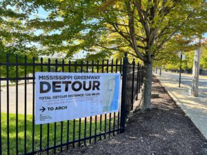
POSTED MARCH 22, 2024– The Mississippi Greenway (Riverfront Trail) is closed to walking/biking traffic between the Old Chain of Rocks Bridge (Missouri entrance) and the northern end of the Chain of Rocks Water Treatment Plant until April 14, 2024. This is to accommodate the last bit of construction for the future Chain of Rocks Park. The Old Chain of Rocks Bridge will remain open but will only be accessible from the Illinois side during this time frame. There will be no access to the bridge from the Missouri side and the gate will remain locked. Please plan accordingly!
Temporary Detour on Riverfront Trail near McKinley Bridge Bikeway through Spring 2024: The Army Corps of Engineers will be repairing the trail near the McKinley Bridge Bikeway through Spring 2024. The greenway will remain open, but the Corps has created a temporary detour around the greenway while this work is underway. Please use caution as you move through this area.
The Chain of Rocks Bridge is opened daily by a team of volunteers; it is open by 9am and locked at dusk.
Flood update- use caution when passing through the area around Maline Creek. The jersey barriers along the edge of the greenway were moved by summer 2022 floodwaters. There is fencing across the greenway in this area across the greenway but there is space for people walking or riding bikes to go around the fence.
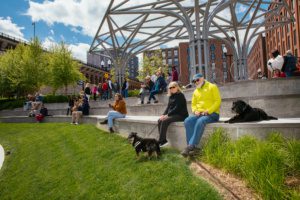
The Mississippi River Greenway between Chouteau and the Old Chain of Rocks Bridge is like no other, stretching from downtown St. Louis, along the industrial riverfront to the historic Route 66 bridge. The greenway is mostly flat and entirely sunny. It offers views of the working riverfront and Mississippi River that even most native St. Louisans have never seen before. This greenway has a long history and many champions – check out more information on Trailnet’s website.
Read MoreAmenities
Getting Here
The greenway is located near the heart of downtown St. Louis. The trailhead is located at Biddle Street just a few blocks north of the Martin Luther King Bridge.
Each greenway is managed in cooperation with different municipalities and parks departments, who set the rules for greenway use, parking and hours of operation. Greenways often span multiple municipalities, so please be aware that these rules can change as you travel along the trail. Please be sure to follow all posted rules and regulations while you are living life outside!
Click one of the buttons below to plan your route with Google Maps.
You can access this section of the Mississippi River Greenway at several points via Bike St. Louis. In downtown St. Louis, you can access the greenway on Chouteau Avenue, Chestnut Avenue through the Jefferson National Expansion Memorial and on Washington Avenue. North of downtown you can access the greenway on Mullanphy Street, Branch Street, Riverview Boulevard and Chambers Road.
You can access this greenway by buses #40, 41, 60, 61, 64, 78, 90 at the Riverview Transit Center. This is a close bike ride or walk to the Riverfront Trail on Riverview.
You can access this section of the Mississippi Greenway from the Convention Center Station and the Arch-Laclede’s Landing Station.
ALERT: The parking lot on the Missouri side of the Old Chain of Rocks is closed. Do NOT be tempted to park along the side of Riverview Drive on the Missouri side of the Old Chain of Rocks Bridge. Cars parking in this area are frequently targeted by thieves. Make sure you have a pleasant visit by parking on the Illinois side of the Chain of Rocks Bridge! If you park in Riverfront Park, you will have to walk or ride 1.5 miles to access the Missouri side of the Old Chain of Rocks Bridge.
Cruce la Carretera 270 a Illinois, al otro lado del Río Mississippi, para estacionar y ver el puente.
Siempre mantenga sus objetos de valor con usted.
请过270高速,到密西西比河的另一岸停车然后看桥。
请随身携带您的物品。
请不要停车,确保在老桥的旅游愉快
Things To Do
explore history
You can explore history at the Jefferson National Expansion Memorial (AKA The Arch!). Check out the National Park Service website for more information.
fish
You can access the Mississippi River to fish along the majority of the trail.
Trail Info
16.19 Miles
This 16-mile (includes Old Chain of Rocks and McKinley Bridge) paved trail in the Mississippi River Greenway is flat, and offers limited shade. It parallels the Mississippi River and winds it way through both sides of the flood wall that protects the city of St. Louis.
Please use caution when walking or riding on this trail because some sections are considered a levee road; you may see vehicles from adjacent businesses who are authorized to drive on the trail.
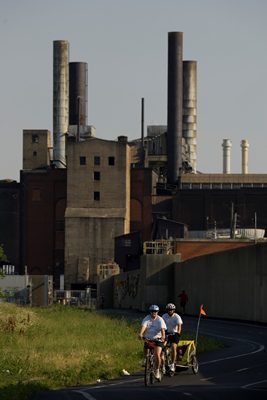
Unique views of the working riverfront.
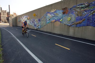
Mural on the Mississippi River Floodwall.
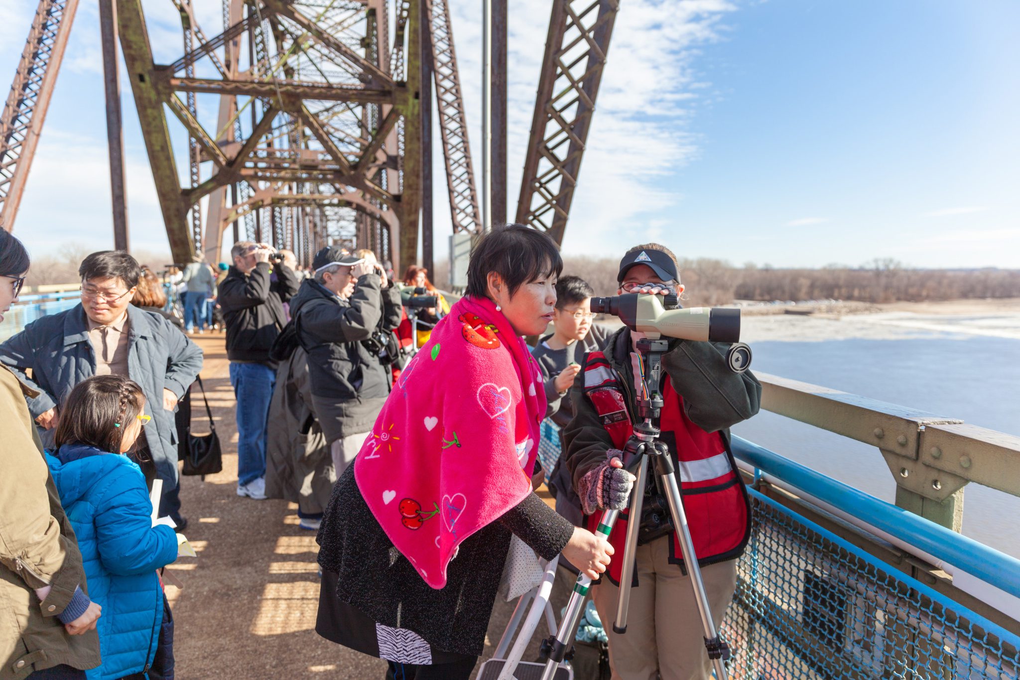
Old Chain of Rocks Bridge
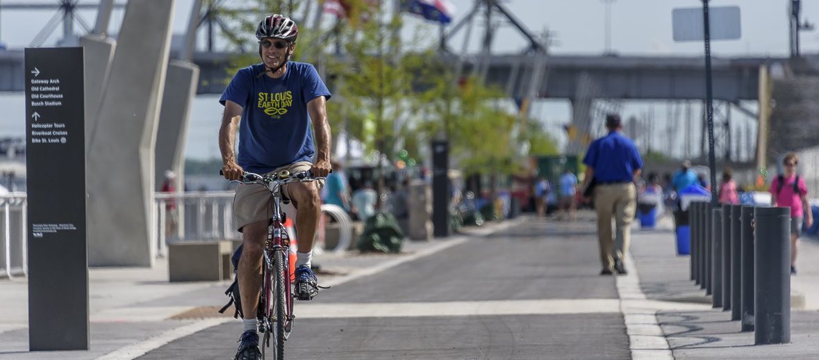
Downtown St. Louis Riverfront beneath the Arch
Events & Programs
Trailnet 2024 Bridge Birthday Bash Bike Ride
May 18th 9:00 am - 3:00 pm CST
Sunset and Snowcones
July 10th 5:30 pm - 7:30 pm CST
Sunset and Snowcones
June 13th 5:30 pm - 7:30 pm CST
Sunset and Snowcones
May 7th 5:30 pm - 7:30 pm CST
Living History Night at the Mary Meachum Freedom Crossing
May 16th 6:00 pm - 7:30 pm CST
Mississippi Greenway Tour: Chain of Rocks Park
May 14th 6:00 pm - 8:00 pm CST