 Contact
 Donate
 Languages
 Events
 Visit Greenways
 Get Involved
 How We Work
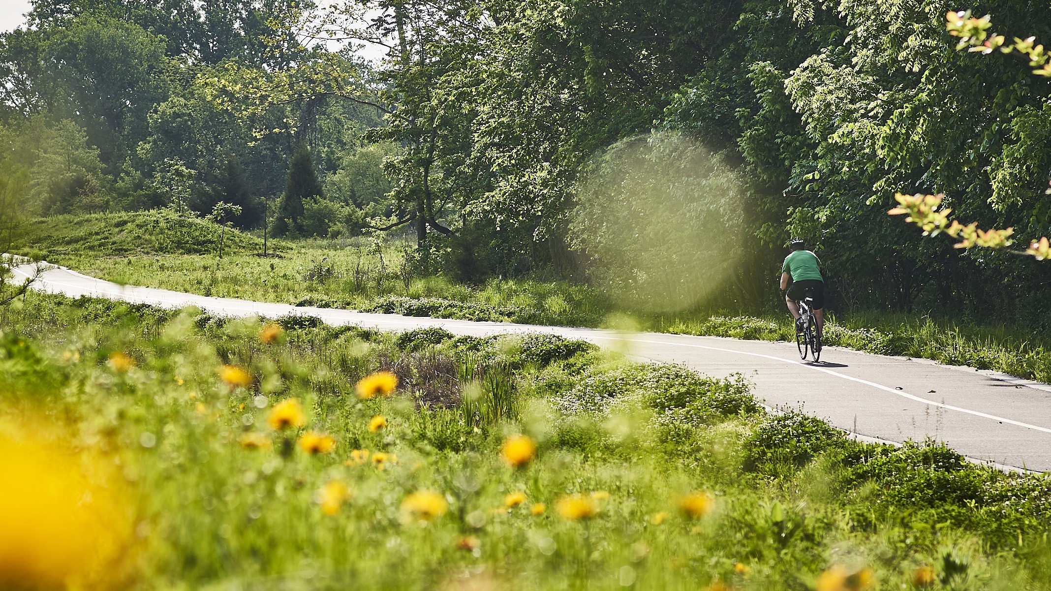
Description
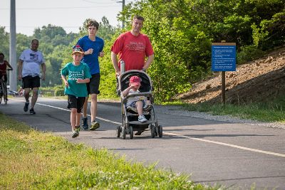
The greenway is mostly flat and sunny offering direct access to the Historic Sappington House complex, Grant’s Farm, U.S. Grant National Historic site, Affton Athletic complex and Officer Blake C. Snyder Memorial Park. Parking is available at several locations and there are restrooms and water fountains available directly on the trail. The connection to the River des Peres Greenway will take you to Carondelet Park, Willmore Park, Fultz Field and Francis R. Slay Park. You can also walk or ride to Loughborough Commons and the Shrewsbury-Lansdowne MetroLink Station.
Because this trail travels through a densely populated area, you can use it to ride or walk to other places found along the greenway. Restaurants such as The Barn Restaurant at Sappington House, Applebees, Crestwood Elementary School, Cor Jesu Academy, Friar Tucks, the Oak Bend Library, Crestwood’s Whitecliff Park and Grant’s Cabin Bed & Breakfast are located along the greenway. There are also places where you can sit and rest in the shade, park your bike or have a picnic.
grants trail
Get Directions to Gravois Greenway (Grant’s Trail): River des Peres Greenway to Holmes & Leffingwell
Getting There
The trailhead at Holmes and Leffingwell is near the intersection of Big Bend Boulevard and Highway 44. The Mysun Charitable Foundation trailhead at Orlando’s is near Highway 55 and Union Road. If you live nearby, there are several ways to walk to this greenway. The newest 1.6 mile extension between Hoffmeister and River City Blvd. has two neighborhood connections. You can access the greenway on foot or bike (no parking) via a ramp at Bayless and Tesson Street.
Each greenway is managed in cooperation with different municipalities and parks departments, who set the rules for greenway use, parking and hours of operation. This greenway spans multiple municipalities and is managed by the following partners:
- Kirkwood to Highway 44: City of Kirkwood Parks
- Highway 44 to Big Bend: City of Oakland
- Big Bend to Pardee Road: City of Crestwood
- Pardee to Weber Road: St. Louis County Parks Department
- Weber Rd. to River des Peres Greenway: St. Louis City Parks Department
Things to Do
Dine There are a few restaurants directly connected to the trail, such as Applebee’s in Crestwood and The Barn at Sappington House, which is open for breakfast and lunch Tuesday through Sunday.
Explore HistoryYou can explore history at Ulysses S. Grant National Historic Site and The Sappington House Museum. Did you know there was once a railroad station called Grant Station near what is now the intersection of Grant and Gravois Roads on this greenway? Read all about the history of the Pacific Railroad (now greenway!) that once crossed President Ulysses S. Grant’s farm from the historians at Ulysses S. Grant National Historic Site here
GrillYou can grill out on the grills located in Whitecliff Park in Crestwood and in Blake C. Snyder Memorial Park.
PlayYou can visit Grant’s Farm, open from May until October (daily during the summer). Admission is free if you ride your bike or walk via Grant’s Trail! You can play at Backstoppers Park near the Holmes Street trailhead and in Whitecliff Park in Crestwood. You can also play on the playground at Blake C. Snyder Memorial Park .
SwimYou can swim in Whitecliff Park in Crestwood. Checkout the City of Crestwood website for more details.
See WildlifeYou can explore the wildlife at Grant’s Farm or even spot a Clydesdale from the trail!
Trail Details
11.47 Miles
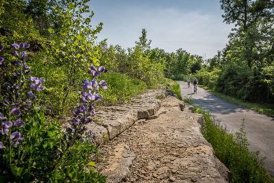
This greenway includes an 11.47-mile paved trail that is mostly flat and sunny. There are also some shady spots near Orlando Gardens as well as through Blake C. Snyder Memorial Park. There is a boardwalk and restored wetland at Hoffmeister along with a recycling hub adjacent to the Republic Services Recycling Facility on Bayless. You can drop your paper, glass or plastic directly into the recycling stream!
If you walk or ride your bike to Grant’s Farm, you’ll avoid the traffic and won’t have to pay to park! There are bike racks on the south side of Grant’s Farm parking lot, directly off the trail.
Amenities
Benches
Bike Racks
Drinking Water
Parking
Playground
Restrooms
Shelters
Tables
Trash
Related News
 News
News
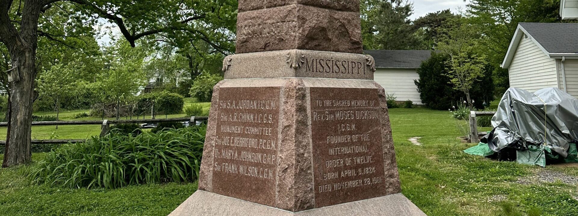
Father Dickson Cemetery: Gravois Greenway (Grant’s Trail)
Read More News
News
Meet the McCulley Family
Read MoreShare Your Greenways Stories
Greenway stories are shared through art and signs, tours, digital content, outreach, and community events. These greenway stories are organized around themes of nature, culture, and history. Share your greenway story by visiting the Share Your Stories page or recording your story at 314-932-4904.
Share Your Story