 Contact
 Donate
 Languages
 Events
 Visit Greenways
 Get Involved
 How We Work
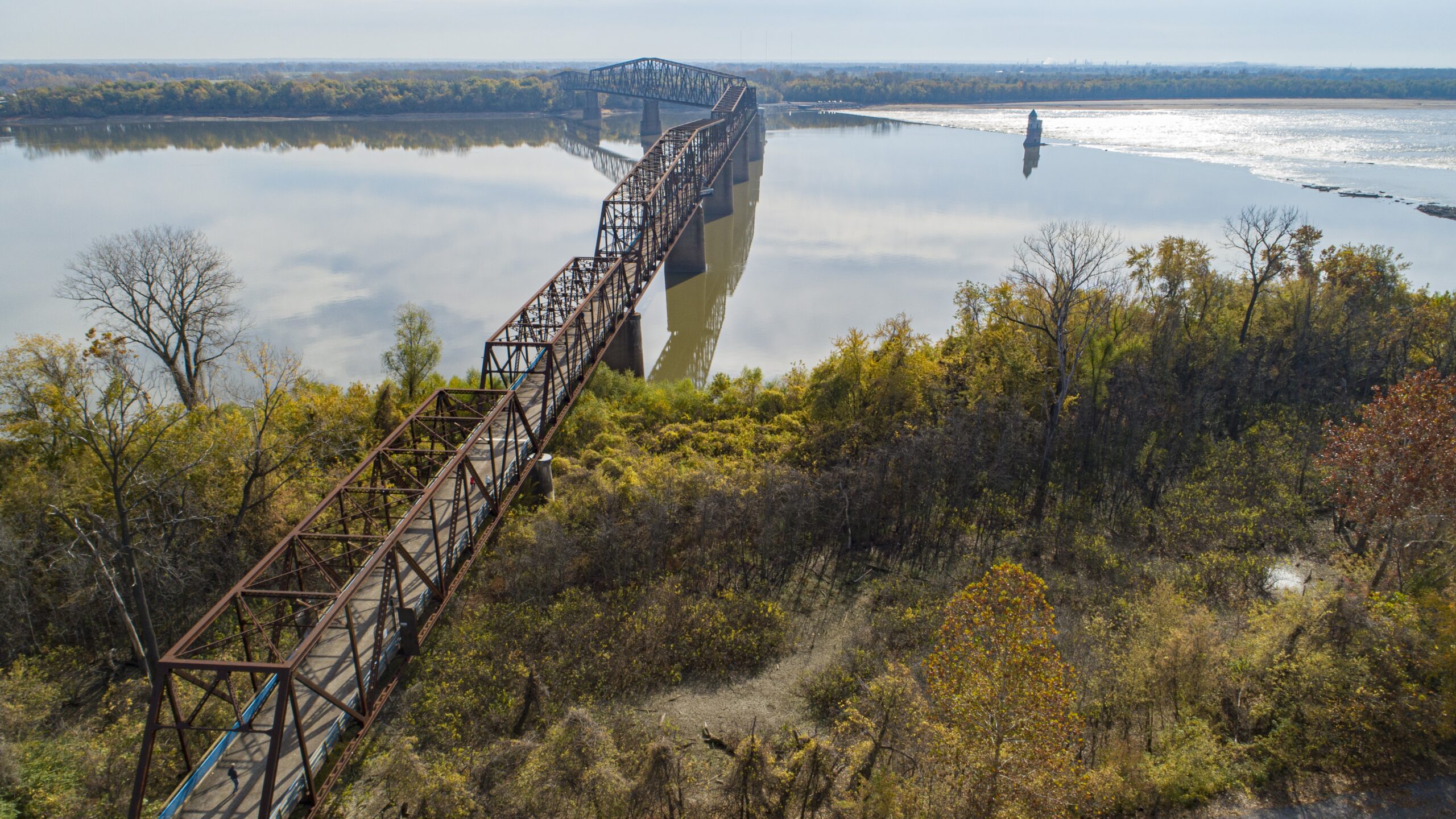
About
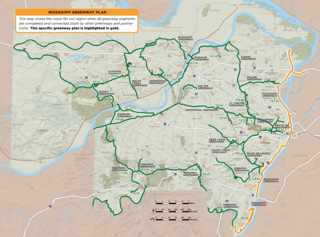
The 32-mile Mississippi Greenway (formerly known as the Confluence Greenway) is a major greenway with a long-term plan to connect with the Missouri Greenway, Maline Greenway, the Arch grounds and Brickline Greenway, River des Peres Greenway, and Meramec Greenway south of downtown St. Louis.
The plan for the southern portion of the Mississippi Greenway extends nine miles from downtown St. Louis to the River des Peres Greenway and then ten miles further to the Meramec Greenway.
Related plans:
- North Riverfront Open Space and Redevelopment Plan
Great Rivers Greenway has worked in collaboration with many partners to create a plan to promote economic revitalization of the North Riverfront by transforming vacant property along the Mississippi River into public parks and recreation amenities as well as encouraging private enterprise. - The Mississippi Greenway Park Master Plan
The Mississippi Greenway Park Master Plan continues to build on the previous North Riverfront Open Space and Redevelopment Planning effort completed in 2015. It focuses on the initial park and open space creating the synergy for future.
Please note, if you saw dashed lines representing “Future Greenways” on the interactive map but don’t see those segments listed here, those projects are part of the overall plan but haven’t yet been studied individually. As soon as there is information to share and an opportunity for community engagement, those projects will have their own pages linked here!
Greenways to Visit
- Mississippi Greenway: Chouteau Riverfront to Old Chain of Rocks Bridge (Riverfront Trail)
- Mississippi Greenway: Cliff Cave Park
- Mississippi Greenway: Jefferson Barracks Park to River City Casino