Submit your comments about Brickline Greenway for federal funding consideration

Through September 24, 2020, you have the chance to submit your comments about projects that seek federal funding through East-West Gateway’s Transportation Alternatives Program (TAP). TAP funds can be used for projects such as bicycle and pedestrian facilities, Safe Routes to School infrastructure or programming, community improvement and environmental mitigation activities, and preservation of historic transportation facilities.

We’ve tried to make it as easy as possible – use the form below to send your feedback on this greenway project. We also encourage you to look through their full list (there are several of our partners seeking funding on greenway projects) and give any feedback you have on any or all of the opportunities. It only takes a moment and is a great way to make sure your voice is heard. East-West Gateway staff will evaluate the feedback, applications and make recommendations in January 2021 to the Transportation Planning Committee.

Maline Greenway Update: Ted Jones Trail to Forestwood Park to W. Florissant Ave

The master plan for the seven mile Maline Greenway is an east-west link between the Mississippi Greenway (sometimes called the Riverfront Trail) and the St. Vincent Greenway in North St. Louis County. The first phase of the greenway was completed in 2019 in Bella Fontaine County Park. This phase will link the Ted Jones Trail to West Florissant Avenue through Ferguson. It will make it possible for people to connect to neighborhoods, businesses, schools and parks via a paved, accessible greenway rather than navigating a narrow shoulder along a busy roadway.


Project Location:
This 1.5 mile stretch of the Maline Greenway will link the Ted Jones Trail to Forestwood Park and then on to West Florissant Avenue. By connecting to the Ted Jones Trail, it also opens up a connection to the University of Missouri-St. Louis campus and the St. Vincent Greenway. From the Ted Jones Trial northern trailhead, the Maline Greenway will run eastward along Paul Ave and Elizabeth Ave before turning southeast on Ferguson Ave and connecting into Forestwood Park. The greenway winds through the southern side of the park and connects into the Lang Royce neighborhood along Maline Creek before ending at a new trailhead located on West Florissant Ave.

Current Status:
The project was awarded $2 million in federal Surface Transportation Program funds in 2019 that will be used for constructing this long-awaited connection through Ferguson. As the design moves forward in 2020 and 2021, we will be reaching out to community members to share updates periodically and gather feedback from select focus groups. There is still plenty of design work to be completed before the federal funds are made available to us in October of 2022. Construction is slated to begin in late 2022.

Kiener Plaza Project

Kiener Plaza Guest Services Building

With the goal of ensuring an excellent visitor experience, we have been working with the community to design and build a new guest services building on Kiener Plaza.  It will be constructed with CityArchRiver funds set aside exclusively for this project area.  The building will include a workspace for on-site security and provide storage and support space for site maintenance and programs.  The Jefferson National Parks Association (JNPA) is working with us to explore feasibility of a small retail outlet and Explore St. Louis is evaluating staff needs to provide visitor information.

The 600 square foot building will be constructed with  pre-cast concrete panels  on the north side of Kiener Plaza. The south facade will be painted a vibrant green- the color selected by the community during the Fall 2019 engagement and survey.

 Project Partners

  • Great Rivers Greenway
  • Gateway Arch Park Foundation
  • Louis City Parks Department

 Current Status:

The City of St. Louis, Cultural Resource Office & Preservation Board granted approval for the proposed guest services and support building in Kiener Plaza. GRG, Gateway Arch Park Foundation and City Parks Department will now move into the construction document stage which is expected to be complete by the end of the 2020.  Construction groundbreaking is expected in spring 2021 with project completion in fall 2021

St. Vincent Greenway Updates

We are working with many partners to close the gap between the northern and southern segments of the St. Vincent Greenway. When complete, the greenway will stretch between Forest Park at Lindell through the University of Missouri-St. Louis Campus to the North Hanley MetroLink. We’ll complete this greenway in three phases- here’s the latest update on each phase:


Centennial Greenway St. Charles County Update

We are working in partnership with the cities of St. Charles and St. Peters to plan the next segment of the Centennial Greenway in St. Charles County. The goal of this project is to extend the existing greenway (Katy Trail to Heritage Museum plus a .7 mile walking /biking connection over highways 364 and 94) from its current endpoint at Old Highway 94 to Schaefer Park.  This extension will also set the stage for future greenway connections that will make it possible to walk or ride a bike on dedicated walking and biking paths all the way from the St. Peters Rec- Plex to the Katy Trail as well as schools, parks and neighborhoods along the way.

In 2019 and 2020, community members weighed in on proposed routes and amenities for the greenway.  Design is in progress and expected to be bid for construction in 2021-2022. We will also be adding wayfinding signs along the planned Centennial Greenway project that is being constructed by the City of St. Peters which extends from Hackmann Road to Spencer Creek Trail adjacent to Harvester Church of the Nazarene.

 Complete the form below to subscribe to email and/or text updates about this project.

Centennial Greenway: Connections to Schaefer Park & Spencer Creek Trail Updates

  • Share your cell phone number if you would also like to get updates via text. This is optional!


St. Louis Getting New Greenway: Temporary Lane Restrictions on Bayless Avenue Scheduled for Week of February 17, 2020

Setting of New 600-foot Pedestrian Bridge for the Gravois Greenway Will Keep Bayless Avenue Open But Close Some Lanes and Ramps Temporarily

People who travel on Bayless Avenue between Avenue H and Union Road or to access Highway I‑55 should be aware of temporary lane restrictions scheduled for the week of February 17, 2020 to set a new greenway bridge. Use of alternate routes is recommended.

Beginning Tuesday February 18, traffic will be delayed or restricted so crews can install a pedestrian bridge as part of Great Rivers Greenway’s expansion. The 600-foot bridge is comprised of seven individual segments which will be lifted and set in place over a three day period. When complete, the paved greenway will extend an additional two miles from Hoffmeister Ave. to connect the Gravois Greenway (Grant’s Trail) to the River Des Peres Greenway at River City Blvd.

On Tuesday, February 18, 2020, crews will place three bridge segments north of Bayless Avenue; expect the following:

  • Beginning at 9am, bridge segments will be off-loaded from the northbound I-55 on-ramp.
  • The northbound I-55 on-ramp will remain open, but will be reduced in width; traffic may be temporarily delayed until each bridge segment is safely removed from the delivery vehicles.
  • Three segments will be delivered to the site and installed between the hours of 9am and 3pm.

On Wednesday, February 19, 2020, crews will place two more bridge segments south of Bayless Avenue; expect the following:

  • Beginning at 9am, bridge segments will be off-loaded from the northbound I-55 exit ramp onto Bayless Avenue.
  • The Bayless Avenue exit ramp will remain open, but the exit ramp will be reduced in width and traffic may be temporarily delayed until each bridge segment is safely removed from the delivery vehicles.
  • Travelers turning east (right) from the I-55 exit ramp onto eastbound Bayless Avenue should consider alternate routes. During the delivery, all traffic turning east (right) from the I‑55 exit ramp onto eastbound Bayless Avenue will be delayed until each bridge segment is safely removed from the delivery vehicles.
  • Two segments will be delivered to the site and installed between the hours of 9am and 3pm.

On Thursday, February 20, 2020, crews will place the final two bridge segments over Bayless Avenue; expect the following:

  • Beginning at 9am, crews will reduce Bayless Avenue to one travel lane in each direction between I-55 and the Union Pacific railroad tracks. The traffic signals at the intersection of Bayless Avenue and the highway on-ramp and exit ramp to and from northbound I-55 will be set to red flash.
  • A traffic director will be present at all times to direct traffic through the intersection. People driving should follow the directions provided by the traffic director.
  • East-west travel on Bayless Avenue will remain open but will be reduced to one travel lane in each direction. Delays are expected.
  • For those driving larger-than-standard vehicles such as buses or semis:
    • All bus or semi traffic turning east (right) from the I-55 exit ramp onto eastbound Bayless Avenue will be restricted. Use of an alternate route is required.
    • All bus or semi traffic turning onto northbound I-55 from westbound Bayless Avenue will be restricted. Use of an alternate route is required.

“All project partners are working together to minimize inconvenience to the people who live, work and travel in this area,” said Lonny Boring, Great Rivers Greenway Senior Project Manager. “We appreciate everyone’s patience and cooperation as we set the bridge over this busy intersection. Once complete, greenway users will be able to walk, ride a bike, push a stroller or use a wheelchair—all separated from the traffic below.”

All work is weather-permitting and could be shifted due to inclement weather or other delays. Greenway construction is expected to be complete in late spring 2020; community members are invited to a celebration on June 4. Stay tuned for details at www.GreatRiversGreenway.org/events.

St. Vincent Greenway: St. Vincent County Park to Rock Road Transit Center

We are working with the Missouri Department of Transportation, Bi State Development, St. Louis County Parks and the City of Pagedale on a 0.5 mile connection from the Rock Road Metro Transit Center to St. Vincent County Park. This project is a critical connection that will not only help close the gap between the northern and southern segments of the St. Vincent Greenway, but also provide a paved, accessible space for people to walk, ride bikes or use a wheelchair between the St. Charles Rock Road Metro Transit Center, St. Vincent County Park, and businesses along the way.

We are coordinating this project with the Missouri Department of Transportation’s planned improvements to St. Charles Rock Road from the St. Louis City limits west to I-170. While designs are not yet final, you can take a virtual “walk” through the project to get a better idea what the finished greenway segment will look like and where it will take you!

Gravois Greenway: Grant’s Trail Connection to River des Peres Greenway Update January 2020

Still on track for late spring, early summer 2020 opening of two mile expanded greenway; bridge over River des Peres delayed by floods & high water

Last year’s rain and historic flooding presented many challenges for the Gravois Greenway: Grant’s Trail connection to River des Peres Greenway. The good news is we are still on track for a late spring- early summer 2020 opening of the 2-mile expanded greenway from Hoffmeister to River City Blvd. Completion of the final component—the bridge over the River des Peres is dependent on low water levels.

Since March 2019, Mississippi River backwater in the River des Peres prevented crews from building the bridge foundations. After nearly nine months of waiting, water levels dropped low enough in late December 2019 to allow the pile drivers to begin construction. Unfortunately, they were only able to work for about ten days before the water rose again and all work has stopped. Crews were able to successfully install all of the steel supports that go down to bedrock during that time. This week’s drenching rainfall has delivered another setback. We are keeping our fingers crossed the water drops  soon—and stays down—so we can build the bridge.

High ground water and soggy conditions impacted construction on the rest of the greenway extension so we added additional crews to make up for lost time. Contractors have focused their efforts on several projects across the new route. If you drive along Interstate 55 between Germania and Bayless, you’ve likely seen the construction of the new greenway along the east side of the highway. Crews in this area have completed the retaining walls that will keep the slope of the new greenway accessible for people of all abilities. Another crew is working on the foundations for the new 660 foot bicycle and pedestrian bridge that will span Bayless Avenue. This work requires temporary lane reductions in this area; we are working as quickly as possible to get all lanes open.

A third area of focus was between Hoffmeister and Avenue I. Crews removed debris and invasive plants to restore a 1.3 acre green space and emergent wetland. A new boardwalk for greenway users has been set in place and native plants and grasses will be planted later this spring. This will make the wetland a welcoming place for birds, bees, butterflies and greenway visitors alike! While this section is open, we still have landscaping, signage and other punch list items to complete.

We understand that people are excited to see this new greenway for themselves. However, the area from the end of the new boardwalk to the River des Peres is an active construction site and closed to the public. We ask everyone to steer clear of the construction for their safety and to allow the crews to build this new greenway!

Greenway Project Update: September 2019

Here’s a quick update on what’s under construction, what’s coming soon, and what we are planning in partnership with people & partners across the region!

Gravois Greenway: Grant’s Trail

This year’s rain and historic flooding presented a number of challenges for the Gravois Greenway: Grant’s Trail connection to River des Peres Greenway. The good news is we are still on track for a late spring 2020 opening! Work on the bicycle and pedestrian bridge over the River des Peres was temporarily halted due to flooding and work is underway again on the approaches to the bridge. Crews are waiting for the Mississippi River backwater levels to drop another 5-6 feet so we can get all the equipment in place to build the bridge foundations. Unfortunately, heavy rains upstream continue to keep water levels high.

High ground water and soggy conditions impacted construction on the rest of the greenway so we’ve added additional crews to make up for lost time. Contractors are focusing their efforts on several projects across the new route. If you drive along Interstate 55 between Germania and Bayless, you’ve likely seen the construction for the new greenway along the east side of the highway. Crews in this area are building retaining walls to make sure the slope of the new greenway is accessible for people of all abilities. Altogether, the new walls will require about 35,200 blocks of stone. (Save that for a trivia night!) Another crew is working on the foundations for the new 660 foot bicycle and pedestrian bridge that will span Bayless Avenue.

A third area of focus is between Hoffmeister and Avenue I. Crews have removed debris and invasive plants on the soon-to-be restored emergent wetland. They are preparing the site for the new boardwalk and native plants that will enhance the native ecology and make the wetland a welcoming place for birds, bee’s and butterflies. Let’s hope the Farmer’s Almanac forecast for a “Polar Coaster” winter does not cause any further delay.

Bicycle and pedestrian path on MO 370 Discovery Bridge

Construction of the new protected bicycle and pedestrian path on the MO 370 Discovery Bridge is underway! When complete, there will be a concrete barrier separating people walking and biking from cars driving on 370. This will make it easier and safer for people to walk or ride across the river to connect to the Missouri Greenway: Earth City Levee and Bridgeton’s Riverwoods Park in St. Louis County and the Katy Trail and Boschert Greenway in St Charles County. Crews have removed the existing trail on the north side of the bridge and are working on the retaining walls for the new paved connection to the bridge. Construction is expected to be complete in Spring 2019. The City of St. Charles is the lead partner on the project along with East West Gateway, Missouri Department of Transportation, the City of Bridgeton and Great Rivers Greenway.

Katherine Ward Burg Garden

This half-acre plaza adjacent to the Eads Bridge—made possible by a generous estate donation from the Katherine W. Burg Trust—has been designed to be a welcoming open space to attract visitors north from the Arch grounds to Laclede’s Landing. The project was slated to break ground earlier this year, but was delayed due to some important upgrades to the electrical infrastructure in downtown St. Louis. We expect to get the green light to proceed later this fall and construction should take about nine months.

Maline Greenway

We are collaborating with the City of Ferguson on the plans for the next segment of the Maline Greenway that will link the Ted Jones Trail to Forestwood Park and then on to West Florissant Avenue. This will make it possible for people to walk, ride a bike, use a wheelchair or push a stroller to connect to neighborhoods, businesses, schools and parks via a paved, accessible greenway rather than navigating a narrow shoulder along a busy roadway. By connecting to the Ted Jones Trail, it also opens up a connection to the University of Missouri-St. Louis campus! Project partners are currently studying existing conditions and various intersection crossing options in order to develop final design plans for construction starting in 2022.

St. Vincent Greenway

We are finalizing plans to extend the St. Vincent Greenway an additional 0.75 mile from Trojan Park to the site of the former Eskridge High School in Wellston. The route will extend north from Trojan Park along Stephen Jones Avenue and west to the intersection of Plymouth and Sutter Avenues. The expanded greenway will include a small “pocket park” at Plymouth and Stephen Jones that will overlook new native plantings along the banks of Engeholm Creek. These native plants swill not only attract pollinators, but also help slow down and filter storm water before it enters the creek—not to mention be a lovely place to relax and enjoy some fresh air! Plans are nearing final design and our team is coordinating with utilities and securing necessary permits. We hope to break ground in summer of 2020 and expect the work to last about nine months.

Deer Creek Greenway Update

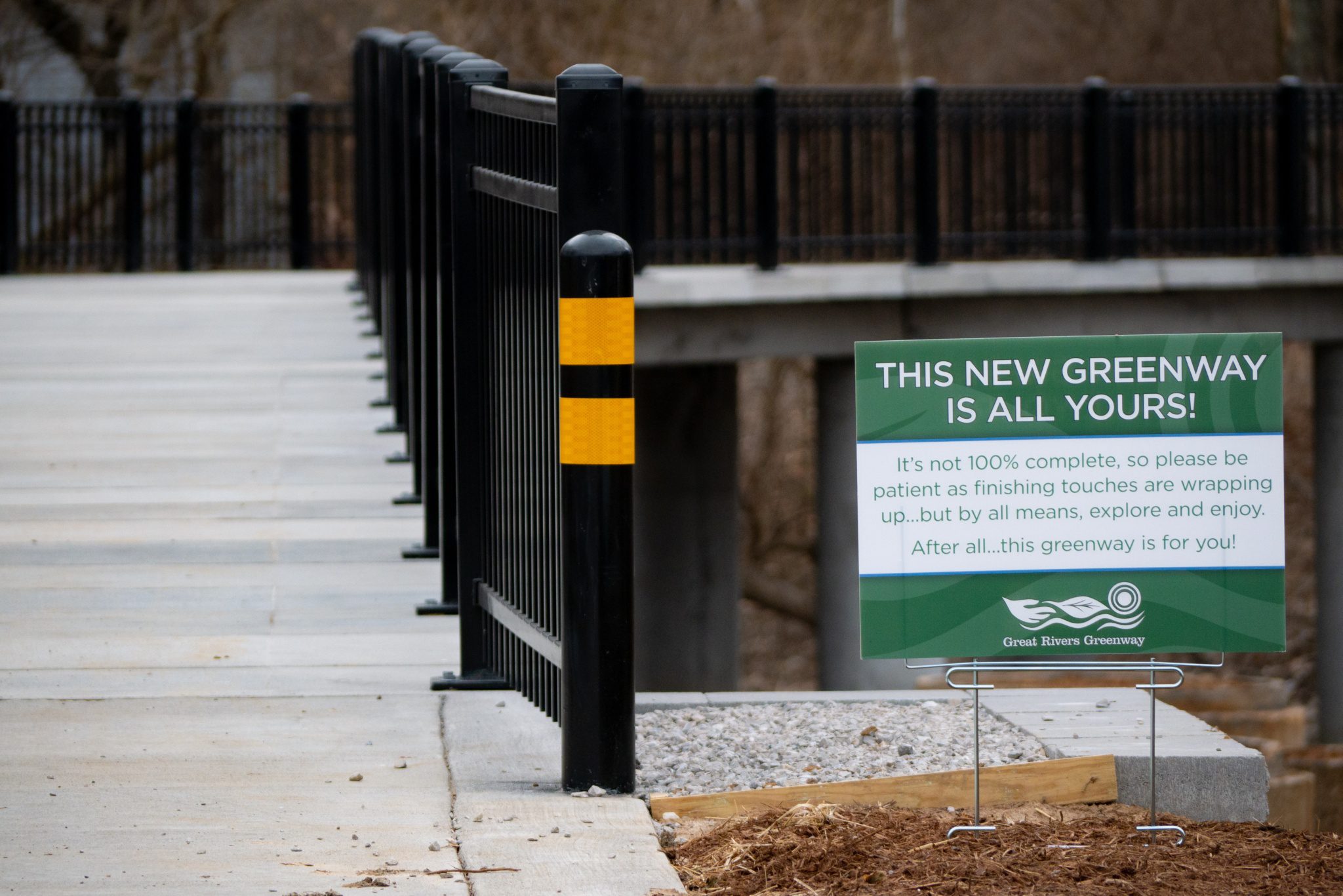
Great Rivers Greenway is dedicated to our mission to make the St. Louis region a more vibrant place to live, work and play by developing a regional network of greenways. We collaborate with partners all around the region to fulfill the community’s vision for this network and we take our job of stewarding the taxpayers’ investment very seriously.

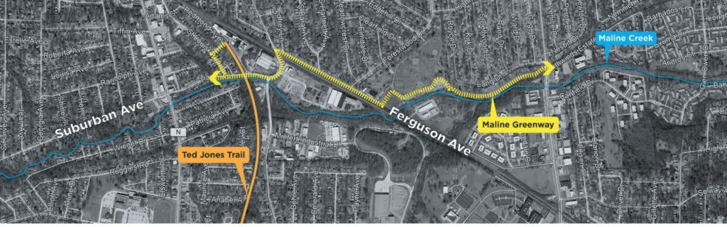
As you may know, we have been working with municipal partners on a project to connect Deer Creek Greenway from Deer Creek Park and shopping center through the cities of Maplewood and St. Louis to connect to the River des Peres Greenway. This project originated in 2004 and has had various alignments studied to determine feasibility over the past 14 years. In 2015, with supporting letters from the Cities of Maplewood and St. Louis and St. Louis County, Great Rivers Greenway successfully secured a $1.6 million federal grant for the northern route option.

When an alternate alignment (along the creek) showed signs of being feasible again in August 2017, Great Rivers Greenway met with the Maplewood City Council to discuss options. The community engagement process continued with a Maplewood public meeting in October, an online survey, an outreach event at the Schlafly Farmer’s Market in Maplewood in December, a community workshop at Maplewood City Hall in December and a neighborhood meeting in January in the City of St. Louis, the other municipal partner on this project. The community’s preference was for the northern alignment and we shared the full results of the engagement efforts with all project partners.

Maplewood City Council discussed the alignment options during several Council meetings and work sessions and had difficulty reaching consensus, reporting a stalemate after the February 13, 2018 Council meeting. The City of Maplewood later communicated preference for the northern route and provided a list of topics and concerns to explore, many of which were outside the scope and timeline of the original greenway project as described in the federal grant.

With these new topics for discussion, we determined the project was not ready to move forward as originally planned, so we declined the $1.6 million from East West Gateway Council of Governments to release this project from those deadlines.

While we declined the grant, we offered the City of Maplewood the opportunity to move forward in the future on a collaborative planning process to develop a new scope for the project along the greenway segment in Maplewood.  The City of Maplewood agreed to move forward and collaborate with us and the City of St. Louis on a feasibility study of the previously established northern route option. Together, we have explored what’s feasible, what funding mechanisms are available, what is within the scope of a greenway project and what is a municipal issue for the City of Maplewood to address. It’s important to note that while we declined the original grant, this does not eliminate the possibility of applying for grants for this project in the future.

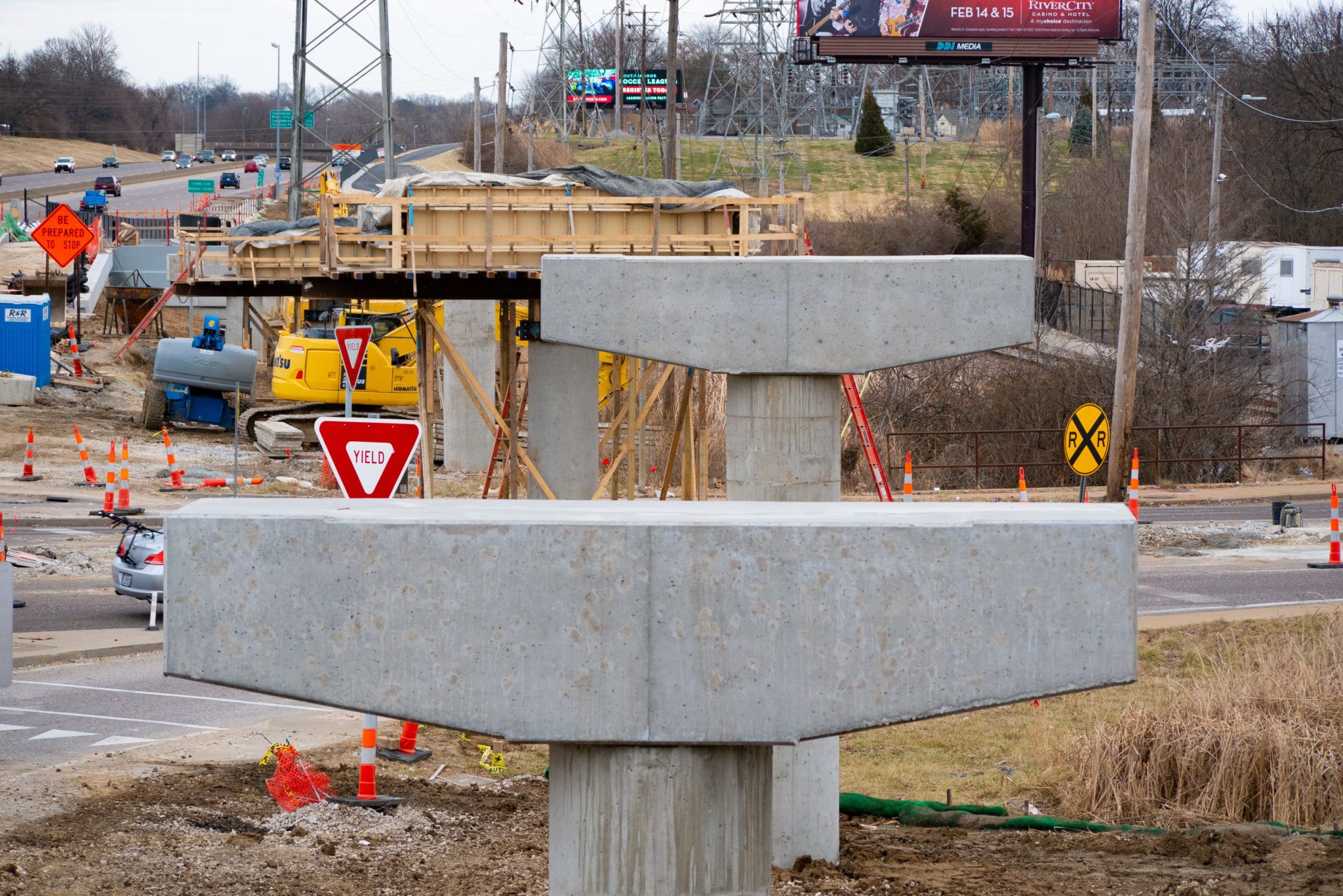
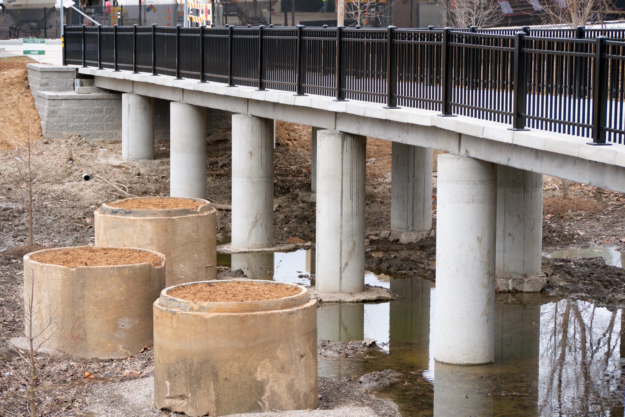
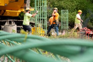
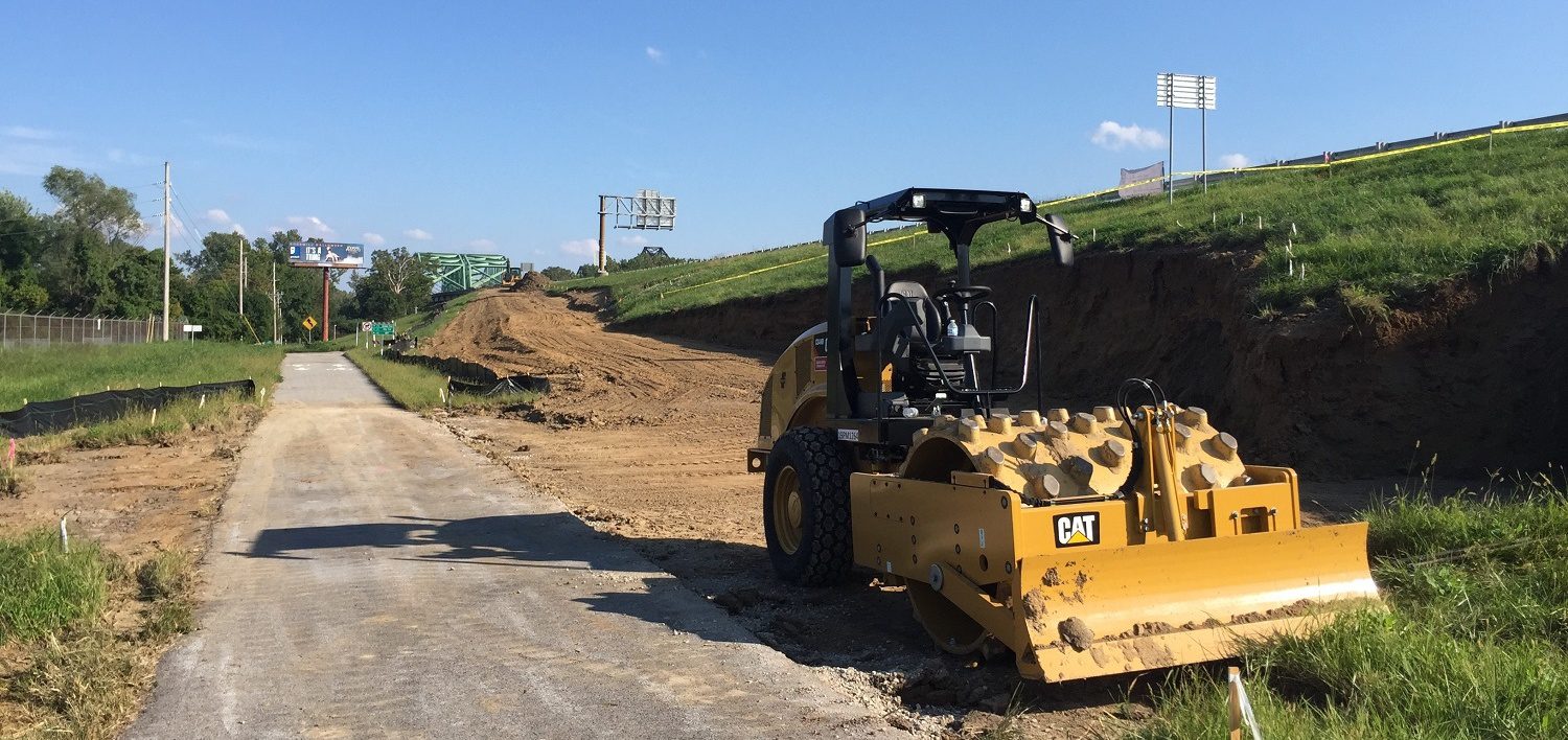
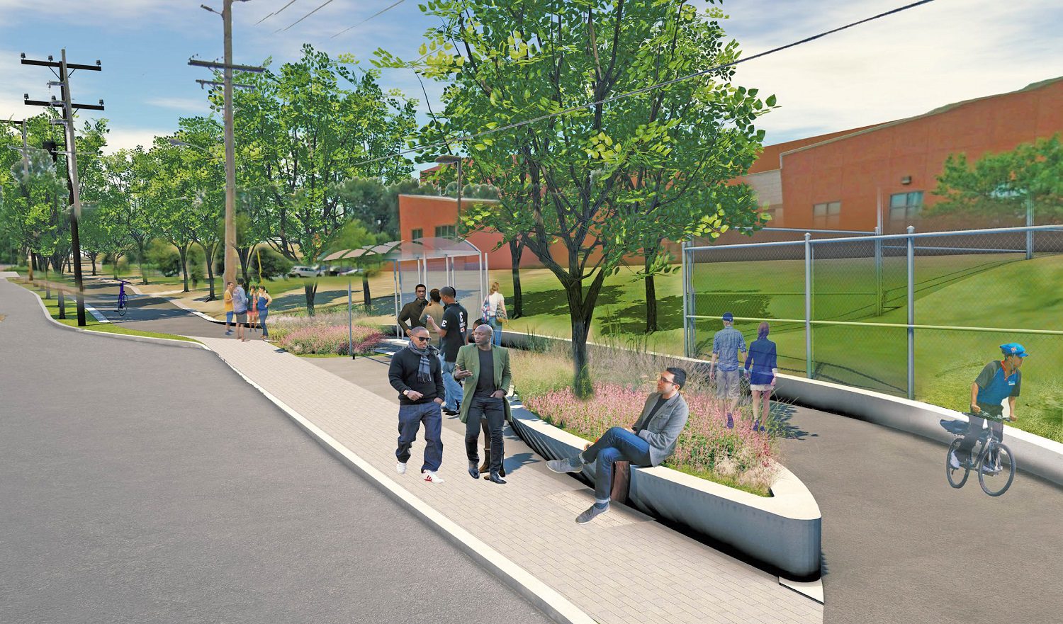
Engineers and other consultants, with community input, completed a safety evaluation of three intersections and developed design solutions that consider the needs of people walking, riding bikes or driving a car.  In Fall 2019, the results were reviewed in detail by representatives of Union Pacific Railroad and the Federal Railroad Administration for those intersections that connect with the train tracks.  The greenway is now in the preliminary design phase. This work will continue through 2020.

We’ll also be working with the City of Webster Groves to develop a small pocket park/pedestrian trailhead at Big Bend and Oxford (formerly McDonalds) that will connect to the future Maplewood greenway.

Archive of Open Houses/Community Meetings

Project partners hosted an Open House and Community Meeting on Wednesday November 14, 2018 at the Maplewood Fire house to share the potential intersection options.

From that 11.14.18 meeting:

At the November 2018 Open House, the community was asked to share feedback about each of the potential intersection options along the proposed greenway extension. Project partners captured this input and prepared a presentation (link below) detailing the community’s preferred option for each intersection along with cost estimates for each option.   On Thursday January 24, 2019, project partners hosted an Open House and Community Meeting at the Maplewood Fire House to share the community feedback.

From the 1.24.2019 meeting:

As always, we will keep you informed as this project evolves and we appreciate your continued input! Questions welcome anytime. Hope to see you out on the greenways or at a program or event soon.
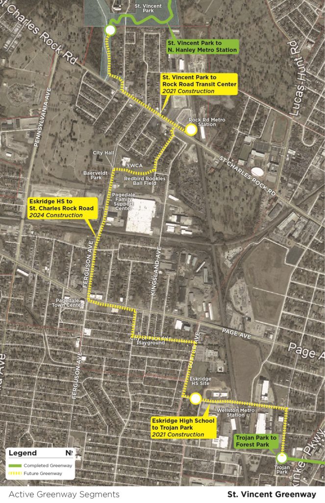