 Contact
 Donate
 Languages
 Events
 Visit Greenways
 Get Involved
 How We Work
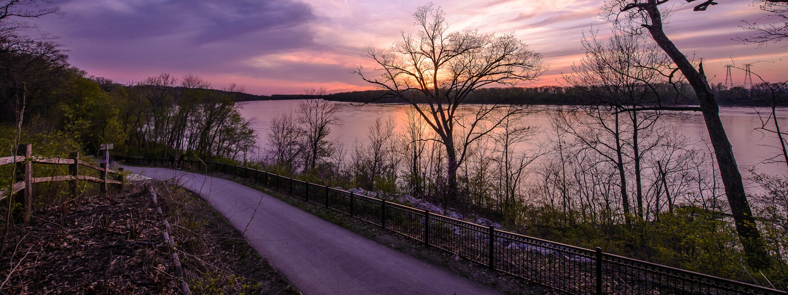
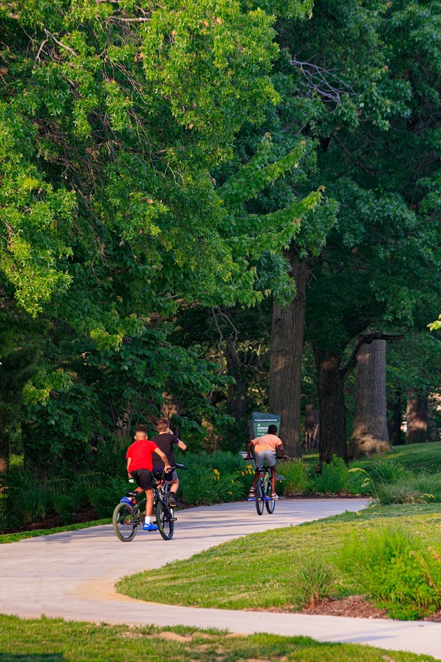
Get out on a greenway to celebrate 3.14 Day or any day! We’ve plotted out eight 3.14-mile routes on greenways across St. Louis City, St. Louis County and St. Charles County. Follow one of our suggested routes or make up your own – you’ve got 140+ miles of greenway to choose from!


Centennial Greenway: Warson Park to Indian Meadows Park
Start in Warson Park where the greenway begins at Warson Rd. Head east on the greenway to the far end of Warson Park. The greenway turns north (this section opened in spring 2025!) and continues through the adjacent neighborhood. Be sure to check out the nature playscape in Indian Meadows Park. There is also a rain garden near Napoleon Blvd. that captures rainwater during storms. Depending on the time of year, you might see some of the 300 native-to-Missouri trees and bushes in bloom along the newest section of greenway. When this greenway was planned, the Olivette community made it clear that native landscaping was a priority! Turn around at Dielman Rd. and walk back to where you started for a total of 2.6 miles, or, to make this a 3.14 mile walk, turn around and head east again to where the path splits. This time, go right and follow the trail to loop around the two baseball fields in Warson Park and back to the parking lot next to Five Oaks on Warson, the Olivette Community Center. Plan your trip here.
St. Vincent Greenway: Rock Road Transit Center to St. Vincent Park
Start at the Rock Road Transit Center and follow the greenway out to St. Charles Rock Road where you will turn right (west) towards St. Vincent County Park along the section of greenway that opened in 2023. Look for the big St. Vincent Greenway sign at Salerno Street! Follow the greenway as it turns and heads north into the park along St. Vincent Park Road. Continue walking or riding on the greenway through the woods (and check out our woodland restoration progress!). You may hear the MetroLink train whistle as you walk! You will pass by Castle Park Apartments (the former St. Vincent Hospital) up on the hill and the Daughters of Charity Cemetery on your right. Head towards the playground and tennis courts in the park. Turn around at the parking lot by the tennis courts and head back to the Rock Road Transit Center. Plan your trip here. You can find a printable adventure map with more information about St. Vincent County Park here.
Centennial Greenway: St. Charles County Heritage Museum to Schaefer Park
Start at the St. Charles County Heritage Museum. Follow the greenway to where it spurs north to cross over highways 364 and 94. Follow the greenway to N. Outer Road, then use the crosswalk to cross over to the stretch of this greenway that opened in 2023 and follow the signs to Schaefer Park. Take a stroll around Schaefer Park and then turn around and head back to the Heritage Museum! Plan your trip here.
Busch Greenway: Duckett Creek Trailhead to KATY Trail
Begin at the Duckett Creek Trailhead in Missouri Research Park. Follow the greenway towards the KATY Trail. When you reach the KATY Trail go left; follow the KATY Trail until you reach the path that connects to the walking and biking path on the Boone Bridge. Turn around and head back to Duckett Creek Trailhead. Plan your trip here.

Centennial Greenway: Shaw Park to Old Bonhomme
Start at the Shaw Park Trailhead and follow the greenway until you reach Old Bonhomme Road. Turn around and head back to the Shaw Park Trailhead. Plan your trip here. Take MetroLink to the Clayton Station and walk about .6 mile extra to start your walk or ride. See route here.
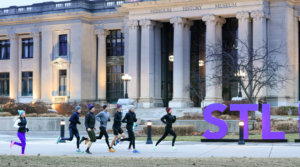
St. Vincent Greenway: Missouri History Museum to Etzel
Begin at the Missouri History Museum at Forest Park. Go around the museum and then cross over Lindell at the traffic light on the east side of the museum. Follow the greenway all the way to Etzel Ave, then turn around and head back to the History Museum. Plan your trip here.
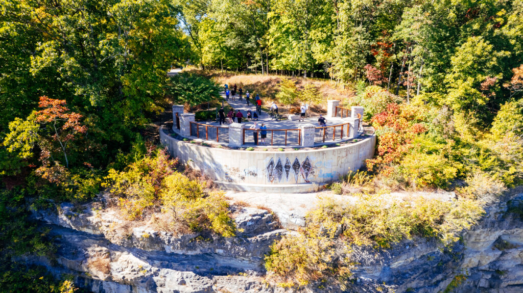
Mississippi Greenway at Cliff Cave Park
Begin at the trailhead in the upper section of the park on Cliff Cave Road. Follow the greenway down the hill to the overlook and check out the amazing view! Walk back up the hill from overlook and take a left to follow the paved greenway to the lower section of the park. After you cross the bridge over Cliff Cave Road, take a left. You will continue downhill, passing by the mouth of the cave! Continue on the greenway down the hill towards the River. Cross the railroad tracks and go left to follow the loop trail. Once you make the loop take a left and walk towards the large pavilion by the river. Enjoy the river view and then reverse your route and go back up to where you started! Plan your trip here.
Sunset Greenway at Sunset Park
Start your walk or ride in Sunset Park. Follow the paved greenway down the hill, all the way down to the river, where the paved trail ends. Enjoy the view of the Missouri River! Head back up to the parking lot and follow the paved path along Sunset Park Drive until you reach Hazelwood Northwest Middle School. Turn around and head back to the parking lot in Sunset Park for a 3.14 mile trip! Plan your trip here.