Boschert Greenway
New Town to Historic St. Charles to Katy Trail
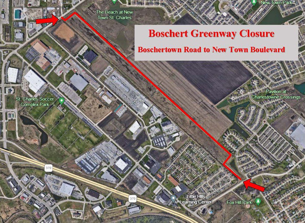
Boschert Greenway from Boschertown Road to New Town Boulevard is temporarily closed to all visitors due to current surface conditions. We are working with partners on a solution. In the meantime, please enjoy the rest of this greenway that remains open between Fox Hill Park and Frenchtown. (POSTED 10/30/2023)
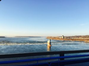
The Boschert Greenway is in St. Charles County and links the Missouri River and Katy Trail, goes through Historic Downtown St. Charles, through Fox Hill Park and up to New Town, a planned community within the city of St. Charles. You can also connect to St. Louis County and the Missouri Greenway: Earth City Levee via a new protected walking and biking path on the 370 Discovery Bridge.
Read MoreAmenities
Getting Here
The trailhead at the Katy Trail is off of Olive Street in St. Charles. The trailhead at Fox Hill Park is near Fox Hill Road in St. Charles. If you live near New Town you can walk to this greenway along New Town Blvd or Boschertown Rd. You can also walk to the connection on Olive St. or walk from Historic Downtown St. Charles.
Each greenway is managed in cooperation with different municipalities and parks departments, who set the rules for greenway use, parking and hours of operation. Greenways often span multiple municipalities, so please be aware that these rules can change as you travel along the trail. Please be sure to follow all posted rules and regulations while you are living life outside!
Click one of the buttons below to plan your route with Google Maps.
You can easily connect to this greenway from the Katy Trail around mile marker 39.5. You can also access this greenway from the shared traffic lanes on Olive Street. Click one of the buttons above to plan your route with Google Maps.
You cannot currently access this greenway via bus.
You cannot currently access this greenway via Metrolink.
You can park at the trailhead to the Katy Trail or at the trailhead in Fox Hill Park.
Things To Do
explore history
You can explore historic St. Charles. Check out the Historic St. Charles website to see what there is to explore.
fish
You can fish on the Missouri River at the trailhead of the Katy Trail in St. Charles.
dine
There are several places you can dine in Historic St. Charles. Check out the Historic St. Charles website for a list of dining opportunities. The Bike Stop Café is a popular dining spot that doubles as a bike shop.
boat
There is a boat ramp where you can launch your boat on the Missouri River at the trailhead of the Katy Trail in St. Charles.
grill
You can grill out at Fox Hill Park in St. Charles. Check out the City of St. Charles website for more info.
play
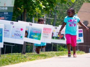
There is a playground, ball diamond, and half-court basketball in Fox Hill Park in St. Charles. Check out the City of St. Charles website for more info. There are Cricket cages in DuSable Park. Visit the City of St. Charles Parks & Recreation website for more information on renting them. There is a Storybook Walk in Fox Hill Park where pages are posted at several stations along the trail, allowing families to enjoy a story as they walk the path and take in the scenery. The story selection changes every month. Click here to learn more.
Trail Info
5.44 Miles
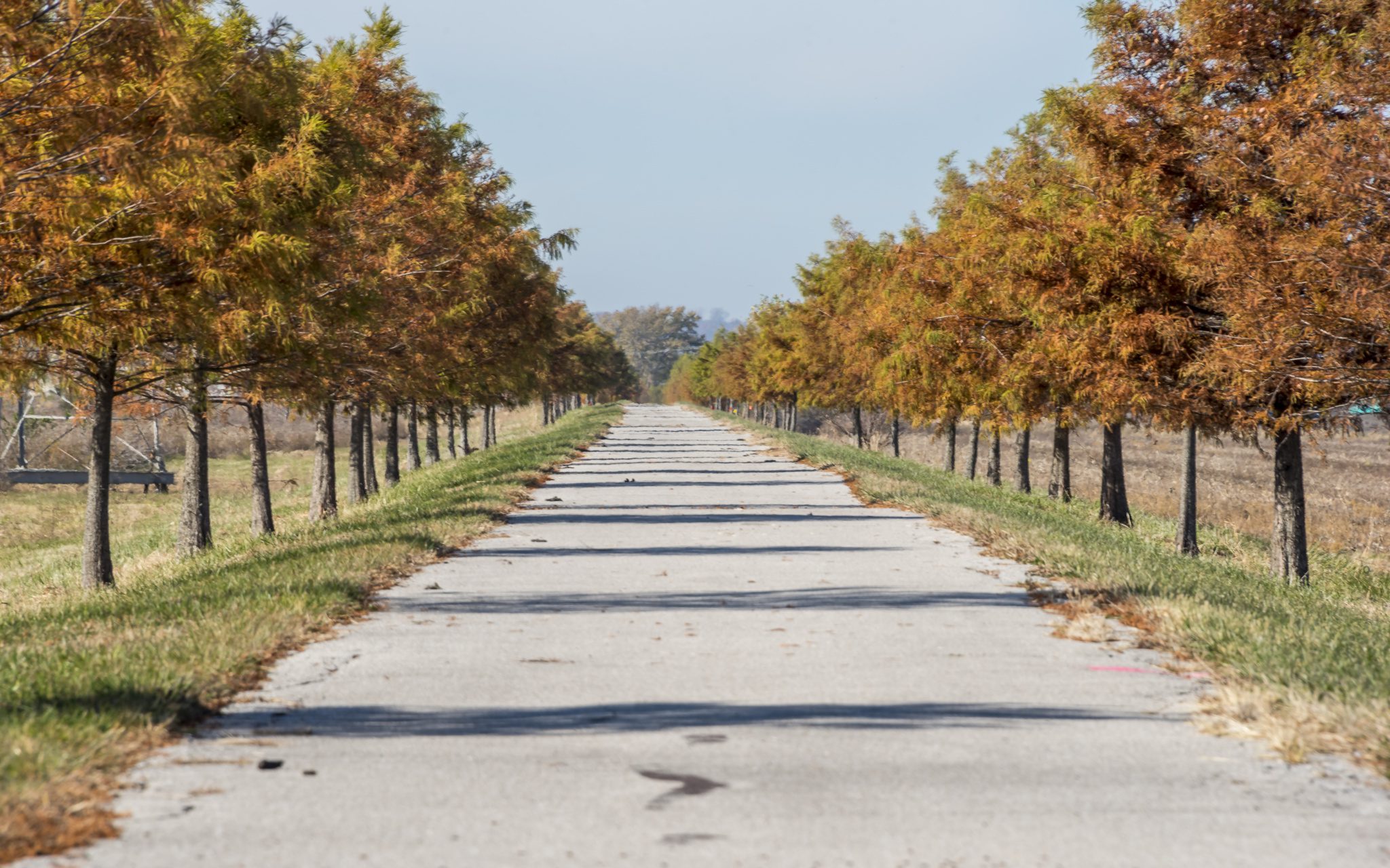
The paved Boschert Greenway trail stretches 5.4 miles between New Town, Fox Hill Park, Little Hills Expressway and Highway 370. It is mostly flat and sunny. From 370 you can follow a bike path along the Fifth Street Extension, turn left on Olive street and connect with the KATY Trail. You can also cross over the Missouri River via a protected path for walking on biking on the 370 Discovery Bridge. Once you cross the river, there is a direct connection to the Missouri Greenway: Earth City Levee. The 25-acre Fox Hill Park has two picnic shelters, a playground, restrooms and two interconnected lakes.
Along the way you will see the “Living Wall” of native grasses and the popular bicycle art sculpture called “Blomstre.” Created by Maplewood, Missouri artist Andrew Andrasko, the 30-foot tall “flower” is made of bike wheels with bike frame petals. Please note that the Fifth Street Extension of the Boschert Greenway Trail is more of a wide sidewalk, but it is separated from the roadway.
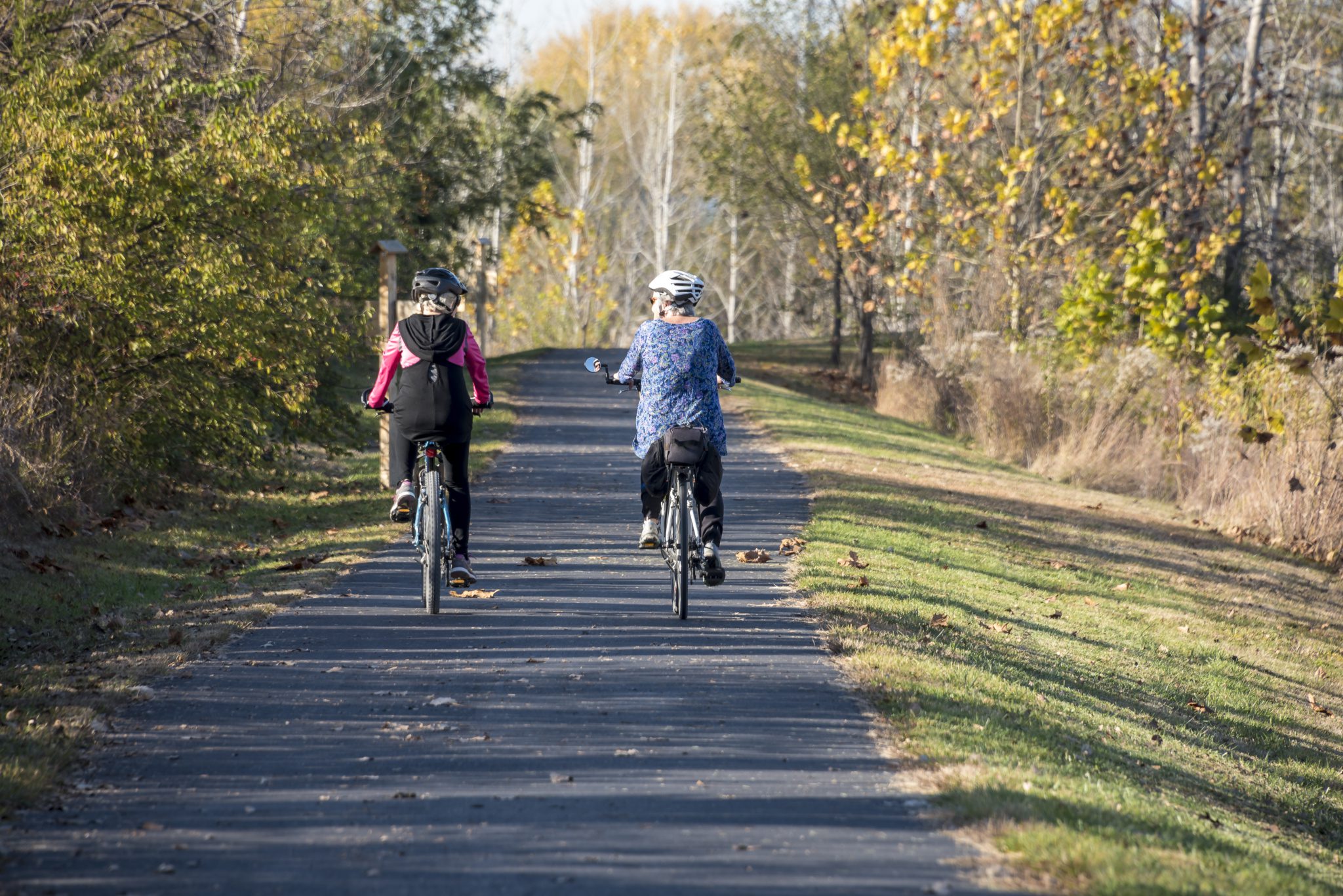
Enjoy the biking trail surrounded by greenery and nature
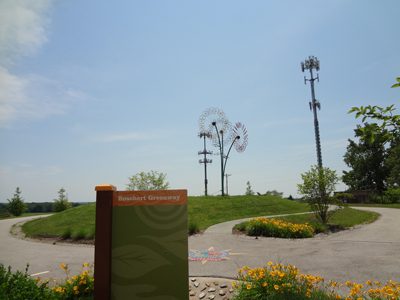
Le Blomstre bicycle sculpture on the Boschert Greenway
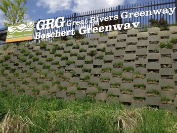
Along the way you will see the “Living Wall” of native grasses and the popular bicycle art sculpture called “Blomstre"
The trail stretches 4.5 miles between New Town, Fox Hill Park, Little Hills Expressway and Highway 370