Phase 2: Trojan Park to former Eskridge High School Site in Wellston
This is the second of three projects that will connect the northern and southern sections of the existing St. Vincent Greenway. It will extend the greenway an additional .53 miles from its current endpoint at Trojan Park on Etzel Avenue to the site of the former Eskridge High school in Wellston.
Project Location: The greenway will extend north from Trojan Park along Stephen Jones Avenue and west to the intersection of Plymouth and Sutter Avenues. The expanded greenway will include a small “pocket park” at Plymouth and Stephen Jones that will overlook new native plantings along the banks of Engeholm Creek. Heading west on Plymouth Ave, the greenway will connect with St. Louis County’s MET Center, STL VentureWorks, and Metro’s Wellston MetroLink Station. The trail also features a MetroBus stop with improved seating located near the MetroLink tracks.
Current Status:
Construction is underway and will be completed in 2022.
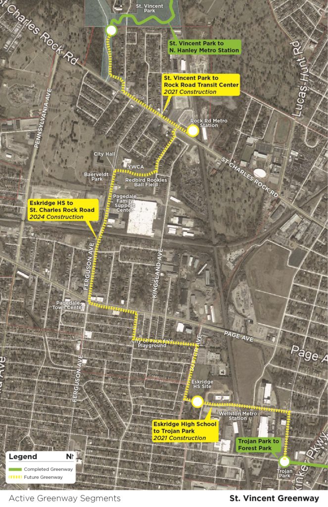 We are working with many partners to close the gap between the northern and southern segments of the St. Vincent Greenway. When complete, the greenway will stretch between Forest Park at Lindell through the University of Missouri-St. Louis Campus to the North Hanley MetroLink. We’ll complete this greenway in three phases- here’s the latest update on each phase: